 In the city, sometimes I feel untouchable. Not always. There are moments, especially with our latest crime wave, when I think, “wow, what if I become an unlucky bystander?” But in general, with the dozens of law enforcement agencies operating in DC, I feel safe.
…and then this week’s horrible events in Beirut and Paris unfolded, and I’m reminded that in any city, even in this beautiful one I call home, we’re vulnerable.
My natural coping mechanism when bad things happen in the world, in addition to being sad and praying for peace, is to obsessively watch and read the news. It’s a pretty terrible way to deal with things and usually results in some quality time hanging out in the fetal position. Whether I was willing to say it out loud or not, I needed to be away from the city, and, thankfully, I already had a hiking trip planned with some of my friends.

The crew for this hike: Sireen, me, Gigi, and Tippa
We headed out to Sugarloaf Mountain, a privately owned park just south of Frederick, Maryland. At just 1,282 feet high, it’s on the smaller side for a mountain; although, it still seemed plenty big when I was hiking up it.
I checked out the hike out in advance on my favorite local hiking resource, Hiking Upward, and opted to send us on the 3.5-hour route that they outlined. Typically, I would have done some additional reading about the hike, but I was kind of distracted Friday night, which led to slightly less planning than normal.
We left from Silver Spring at around 9:00 am. Joining me for this hike: Tippa, Sireen, and Gigi. We arrived at the East View lot a little after 10:00 am (note: the park opens at 8:00 am, so no sunrise hikes here!).
The parking lot was mostly empty, which wasn’t a total surprise. My favorite meteorologist, Doug Kammerer (aka the Superman of Weather), kept telling me that Saturday was going to be a day to bring out the big coats, a possibility which might have scared some people away from outdoor activities. We were kind of afraid of the cold too, three out of four of us brought additional warm layer options. Contrary to my expectations, it was much warmer in the mountain than it was in DC, so the extra clothes hung out in the car.
Steps leading down from the summit
We started our journey on the orange blazed trail. From what I’d read, I knew this path would take us on a very steep 0.3-mile ascent to the summit. If I’d researched a little more, I would have been better prepared for just how steep. We basically walked straight up a rock Spiderman style. The orange trail wasn’t very well defined. At one point, I thought we must have gone off route, and only a chance sighting of a barely visible faded orange blaze let me know we were still on the right track.
Personally, I thought this section was kind of dangerous, especially when coupled with a blanket of dried leaves. In other parks, difficult sections like this usually have some kind of warning sign so at least you know you’re about to take your life into your own hands. Granted, I wasn’t too worried about us getting hurt. We weren’t hiking newbies and we were all outfitted in the appropriate gear, but there was a couple hiking with their elderly mother behind us, and she was definitely struggling over the rocks.
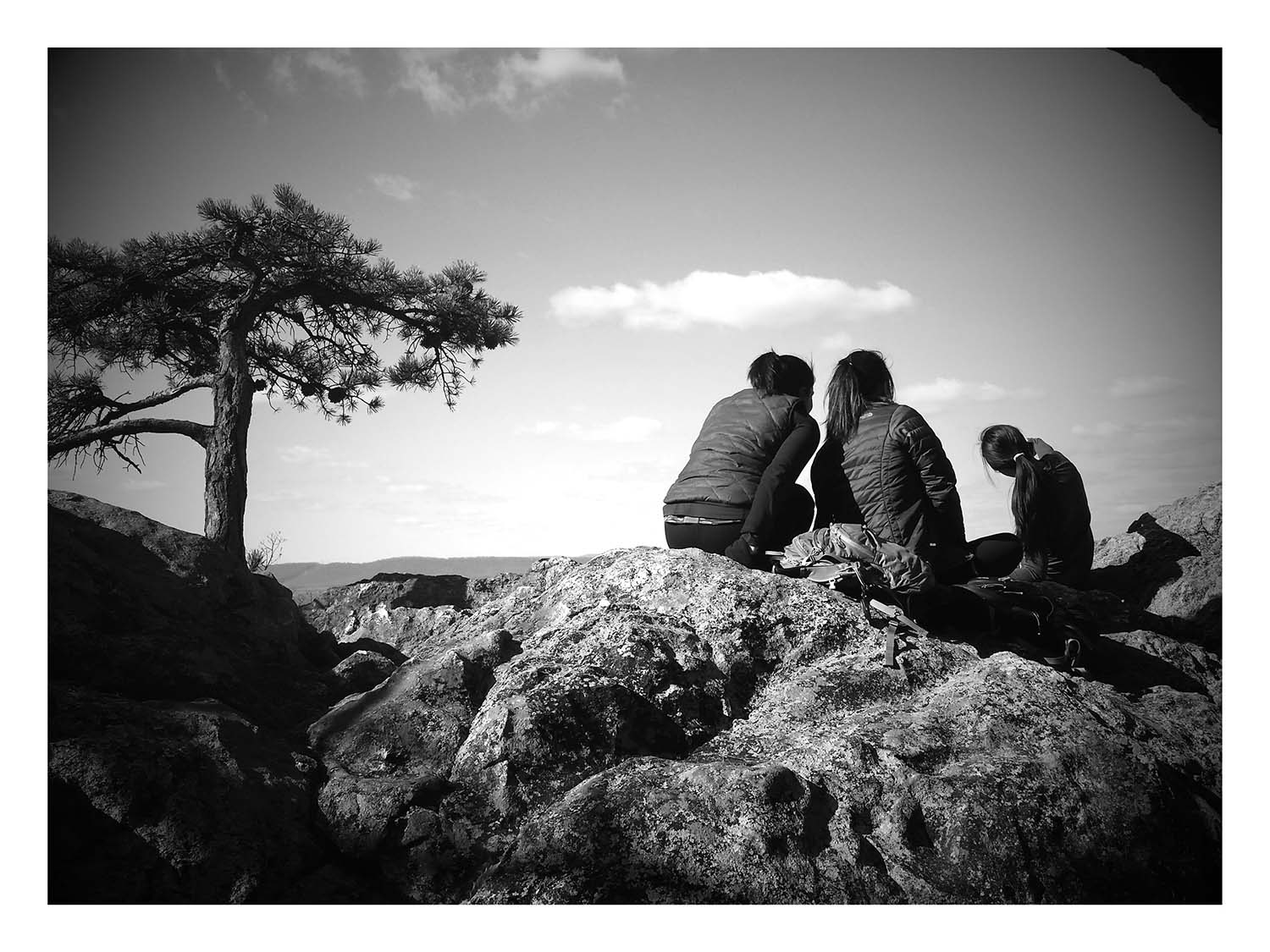
Less than 20 minutes into our hike, we reached the summit and first viewpoints. There were two prime view locations. One was occupied by about two dozen boy scouts practicing some kind of rock climbing exercise, so we hung out at the other rocks and snapped some pics.

Tippa looks off into the horizon at the White Rocks
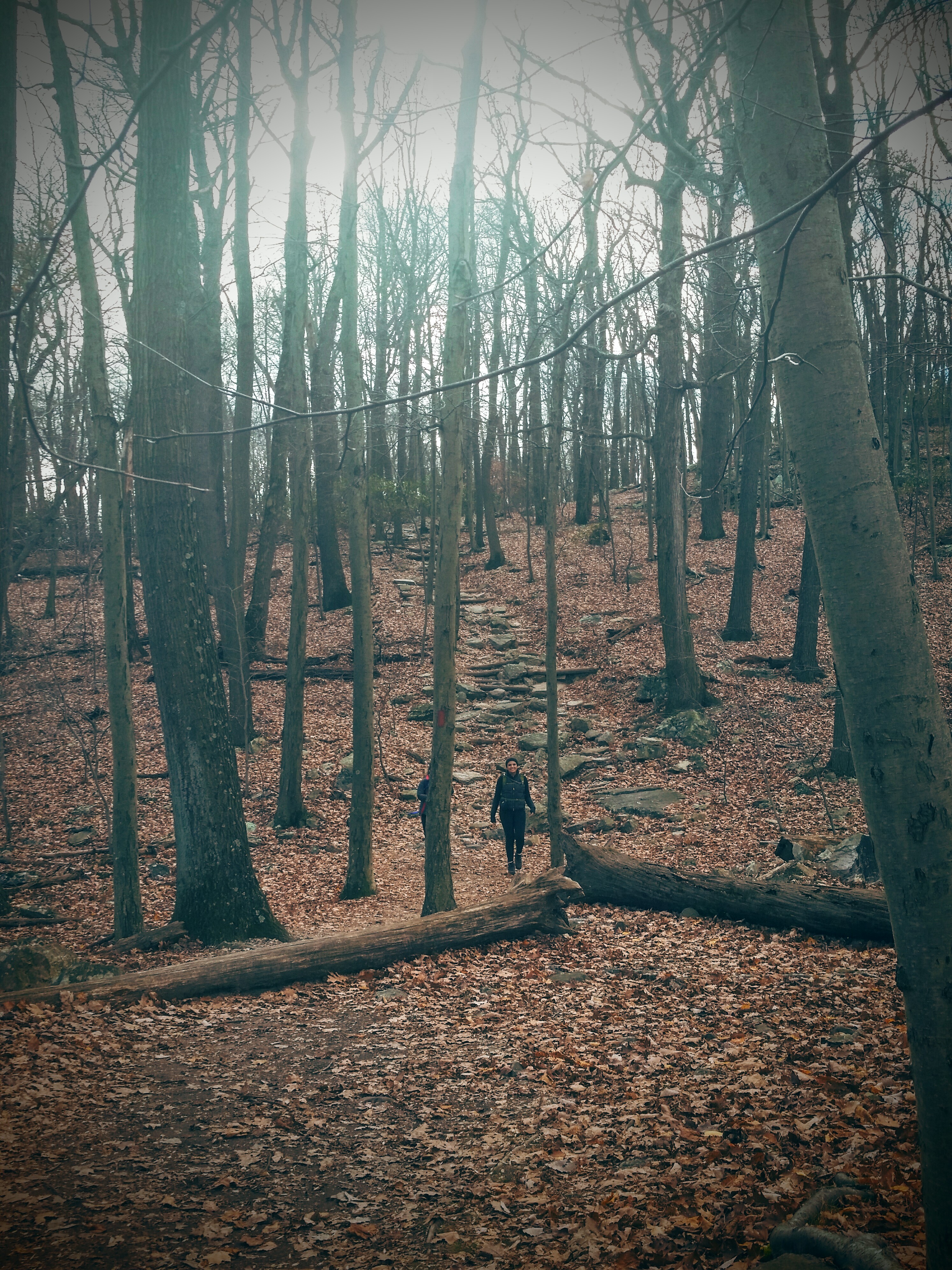
Then, we were back on our way. We turned right and followed the blue blazed northern peaks trail. After the scramble up to the peak, this part of the hike was pretty chill with some mild up and downhill portions. The only thing that gave me pause was a downhill section where the trail had clearly eroded. We ended up doing one of those weird please-don’t-let-me-roll-down-this-hill slide moves to get through that section. Other than that obstacle, there was nothing overly strenuous. It was also very quiet with only a handful of other people out on the trail with us.
As we approached the White Rocks, we passed by a giant pile of smaller, nondescript rocks. There was no sign explaining the meaning of the rocks, but my post-hike internet research has told me they’re the remains of a cairn and many hikers add a rock to it when they pass. From there, it was only a couples minutes until we reached the White Rocks.
There are two viewpoints when you reach the White Rocks. Our favorite was the north view, which had a grouping of rocks that you could sit on and take amazing photos. The drop was very steep on the other side of the rocks, so be careful if you go up there. Tippa, who is fearless, immediately propped herself on the edge of the cliff. I’m 90% sure that she did this just to make me nervous. Sireen and Gigi must have thought my fear was hilarious because they quickly followed her.
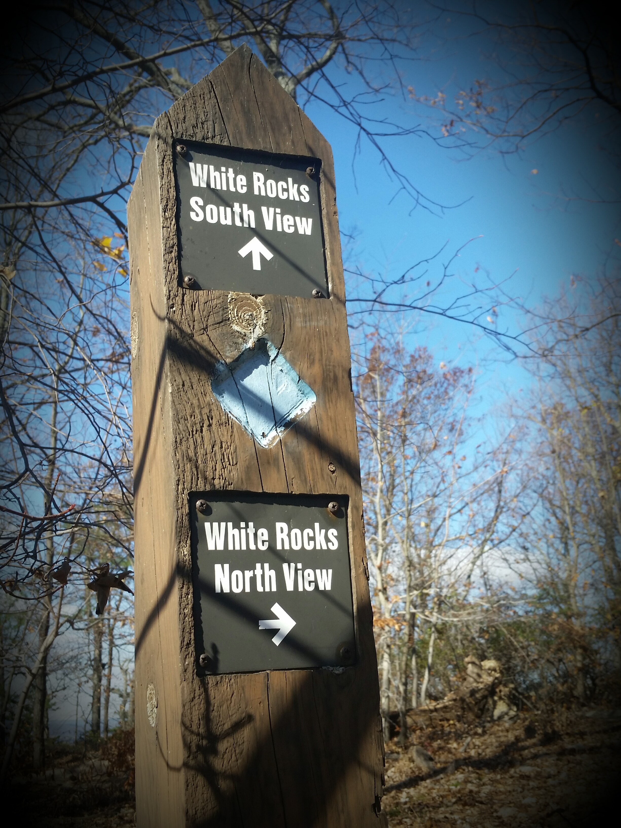
Two options for two fantastic views
After an extended photo shoot, we went back on the blue blazed trail for another mile. This is when things got confusing. Something about the way the trail posts were marked was very misleading and made it seem like we were about to reach the West View parking lot. So when we walked over a ridge and saw parked cars near a road, we naturally assumed this was the lot at the end of the trail.
If I’d paid closer attention to the trail markers and saw that we were only at “B7” or if I’d read Hiking Upward’s instructions a little more carefully, we could have avoided what came next. Instead, we thought that we’d somehow finished the hike 45 minutes early, exited the parking lot, and started walking along Mount Ephraim Road.
We walked for about 0.4 miles, before another group of girls stopped us to ask for directions. We realized when we were talking to them that we were also lost and decided to turn back. The other girls chose to keep going. No idea what happened to them. They may still be in the woods.
We retraced our steps back to the point where things went awry. When we arrived, most of the cars were gone and it was clear that this space wasn’t actually large enough to be a real parking lot. Argh.
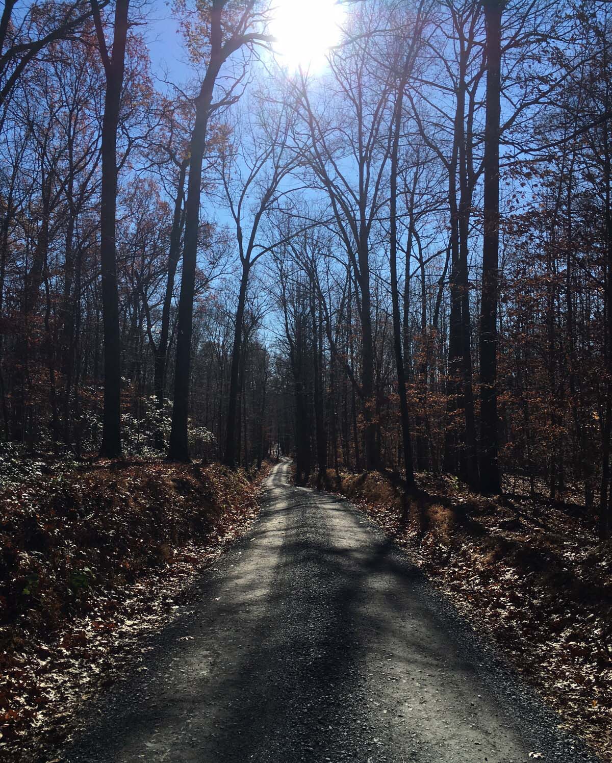
Mount Ephraim Road aka the evil road to nowhere
In need of a trail friend to help us, we flagged down an older guy who was accompanied by his trusty dog, Scooter. He confirmed that we were turned around and still a good 30 minutes from the end of the hike. He was heading in the same direction as us, so he offered to be our guide back to the blue blazed trail.
This isn’t the worst snafu to happen to me on a hike, but I think our error took all of us out of the zone. I know I was unusually cranky at this point, and if it wasn’t for the adorable dog distracting me, I probably would have spent the remainder of our hike whining.
Half an hour later, we finally reached the Potomac lot and from there made our way back to the West View and (finally!) the East View parking area. Including our accidental trek on Mount Ephraim Road, the hike took four hours.
Difficulty – 3
Solitude – 3
Fun – 3

Sitting on the edge of the White Rocks
Not my favorite hike ever, but the views were great. If you skip the orange trail to the summit in favor of the green or red trails, Sugarloaf is a great option for sedate, but fun, hiking.
After the hike, we had a celebratory meal at MoCo’s Founding Farmers. I felt a little ashamed dragging my stinky self into a nice restaurant, but, man, my meal was tasty. It was the perfect way to end a hiking trip.
