This post includes affiliate links, which help support this site at no additional cost to you.
The weekend of February 20, I didn’t have much time for an outing, so I did a small section of a loop outlined in the book 60 Hikes Within 60 Miles: Washington, DC. That small taste wasn’t enough. The tiny bit of the route that I saw was so enticing, I spent the next week thinking about it. What did the rest look like? Where did it lead? Would the finish match the awesome beginning?
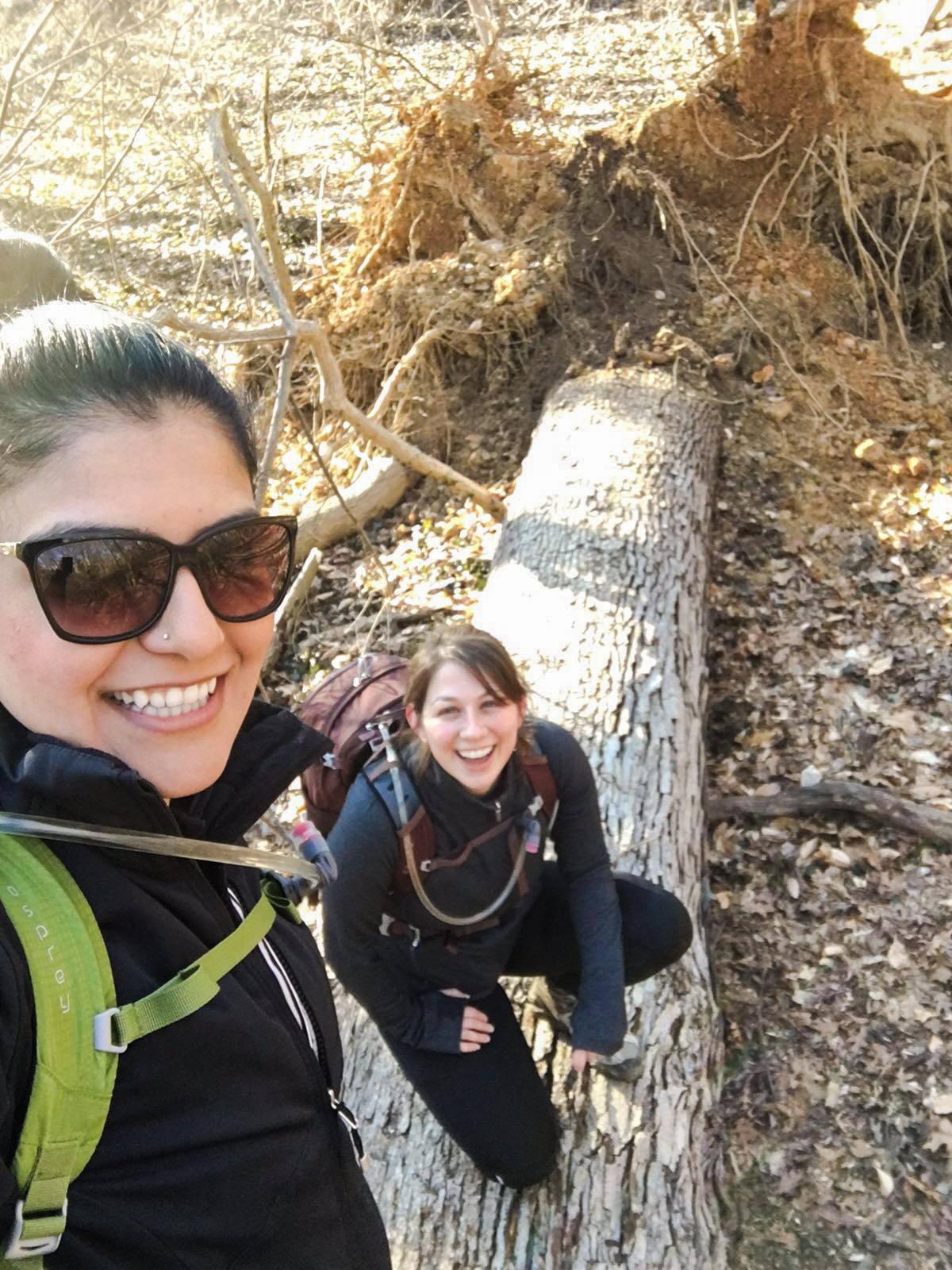
I only had to wait seven days to find out. The weekend called for warmer temperatures and clear skies, making it perfect for a Saturday trek. Sireen drove out to DC bright and early to join me for the loop, and after a brief warm up on the side of the road, we headed to the Zoo.
I normally walk in Rock Creek Park alone, so it was a fun change to have a friend along on the trail. It gave me the opportunity to show off the greatness of Rock Creek’s trails to someone new and share my knowledge of the park.
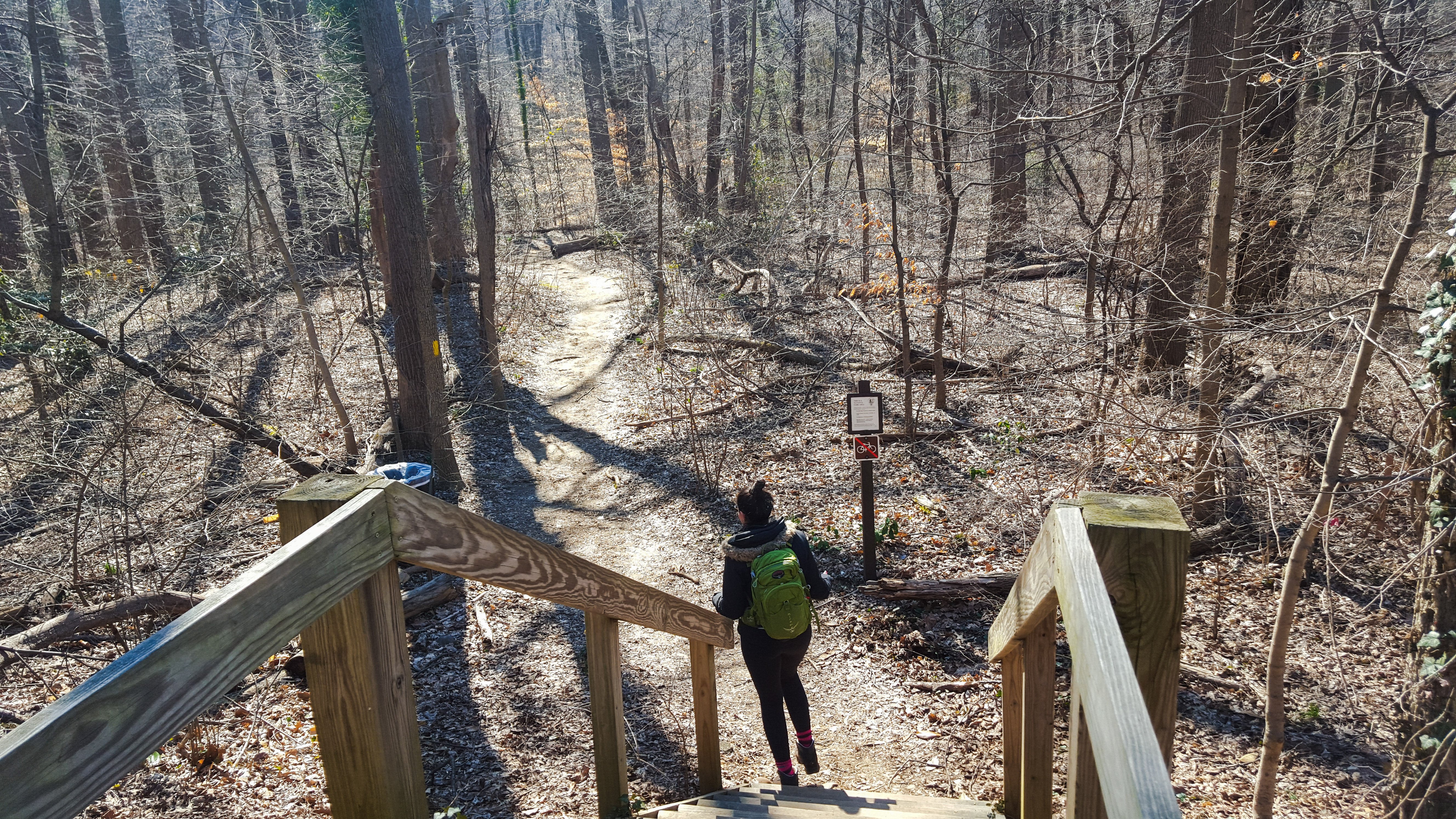
Heading north on Rock Creek Trail, we walked on the paved path for .9 miles until we hit the dirt intersection for the start of Western Ridge Trail.
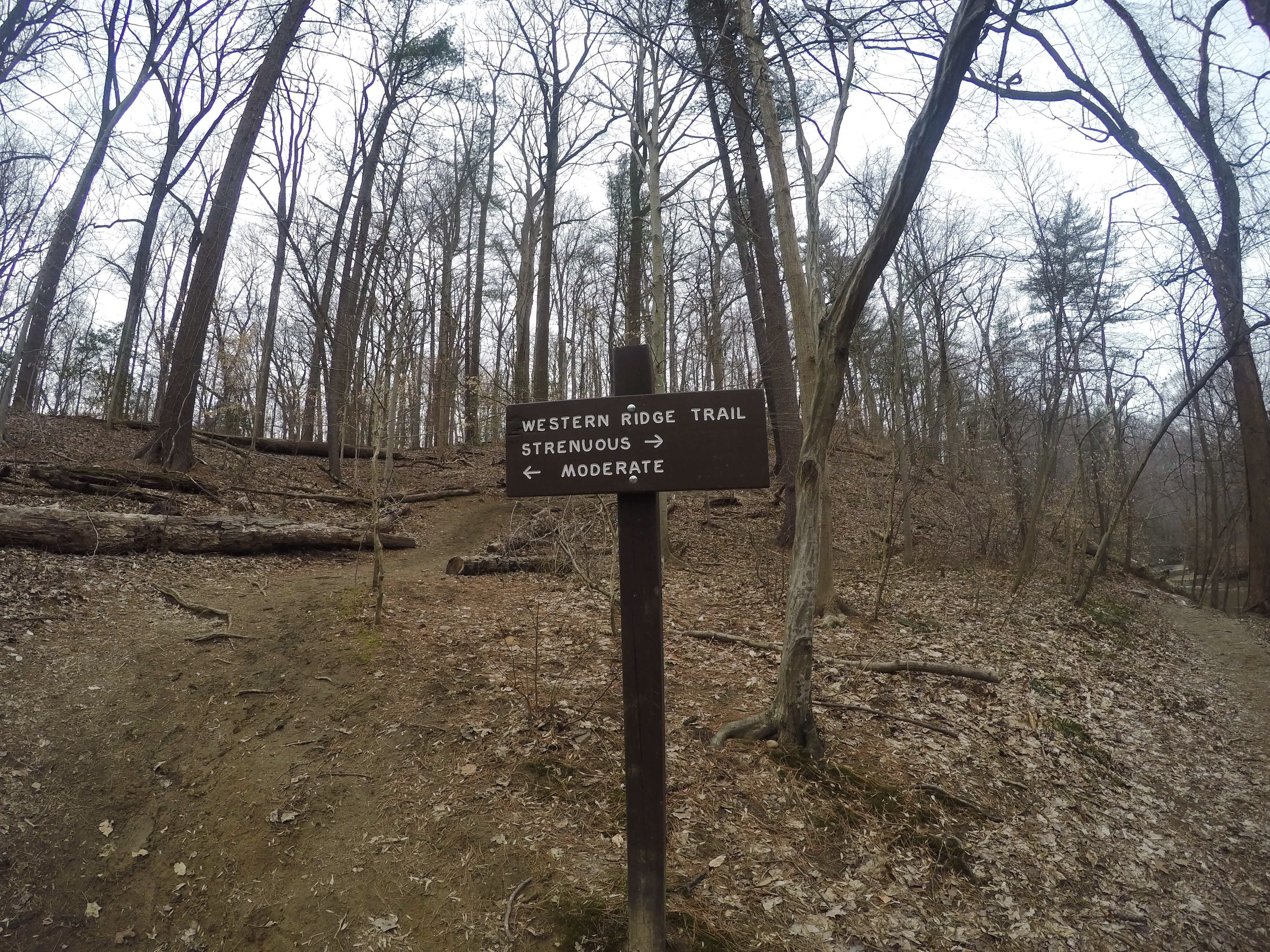
Shortly after getting on Western Ridge, there was a sign directing us to choose between the “moderate” or “strenuous” routes. I tried to do the strenuous route a few months ago and discovered, much to my dismay, that the trail just kind of disappeared into the side of the hill. Lucky for me, I was able to scramble my way up to the higher moderate trail without too many problems. I ran into two hikers up there and they told me the strenuous route was washed away a few years ago during a bad storm. That said, there are no warnings posted, and I see people attempting the strenuous route every time I hike this way. So I guess it’s technically possible to do this trail without dying, but I’m too hesitant to try it again.
The moderate route has a very steep climb up the side of a hill. At the top, it leveled out and gave us an awesome vantage point of Rock Creek. In a quarter of a mile, we approached the end of this section of the trail and made a quick, steep descent into a grassy area with a scenic bridge. If we crossed this field and headed north, we would have hit Peirce Mill. Instead, we hooked a left at the sign for the Melvin Hazen Trail.


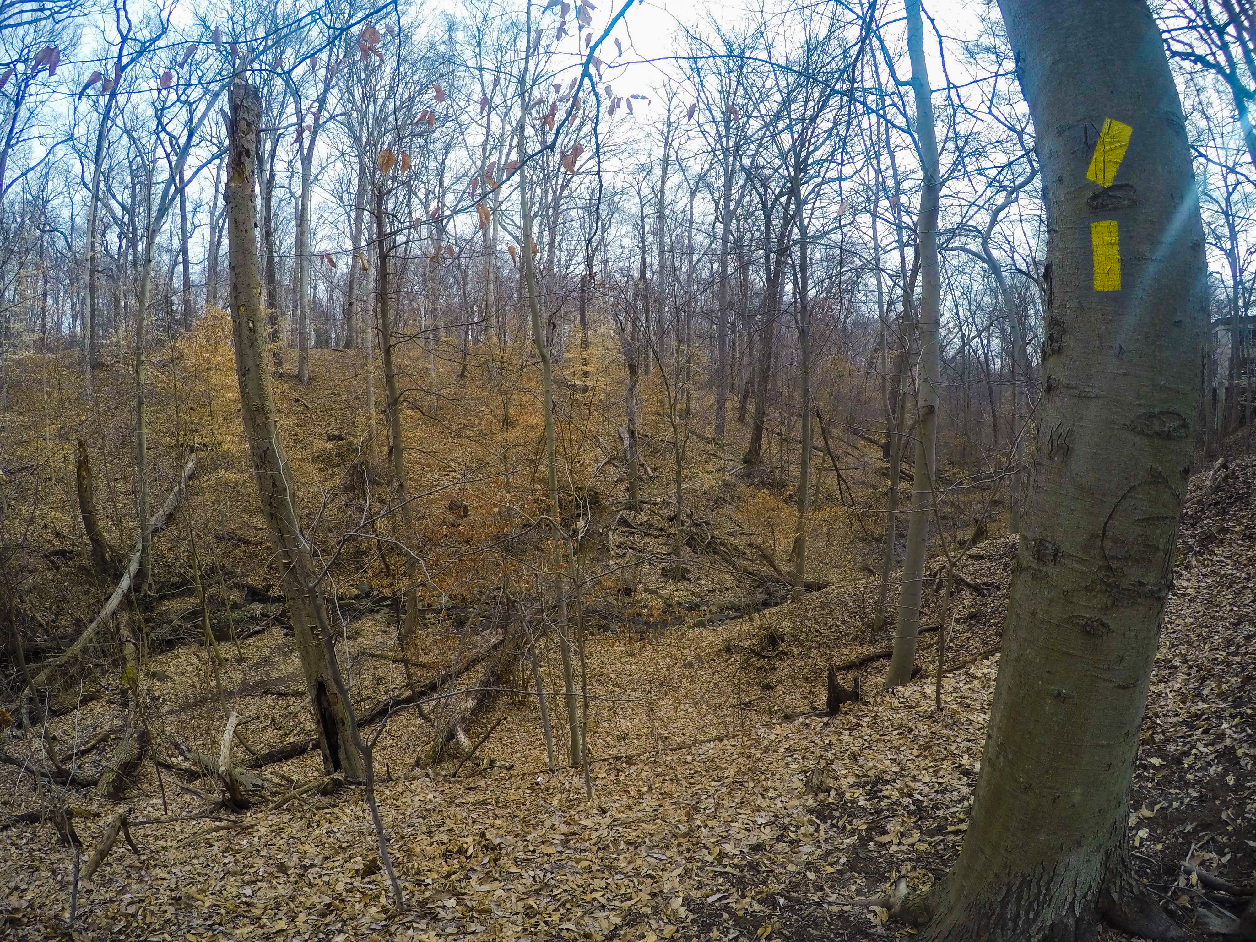
Located within Melvin C. Hazen Park, a small park named after a politician who served as the President of the DC Board of Commissioners from 1933 until his death in 1944, the trail hugs a beautiful rocky creek which we followed as we headed west through the woods toward Connecticut Avenue.
The route was very well marked with bright yellow blazes, and we found it extremely easy to follow. The views were stunning, and it was easy to forget that we were walking in the middle of the city.
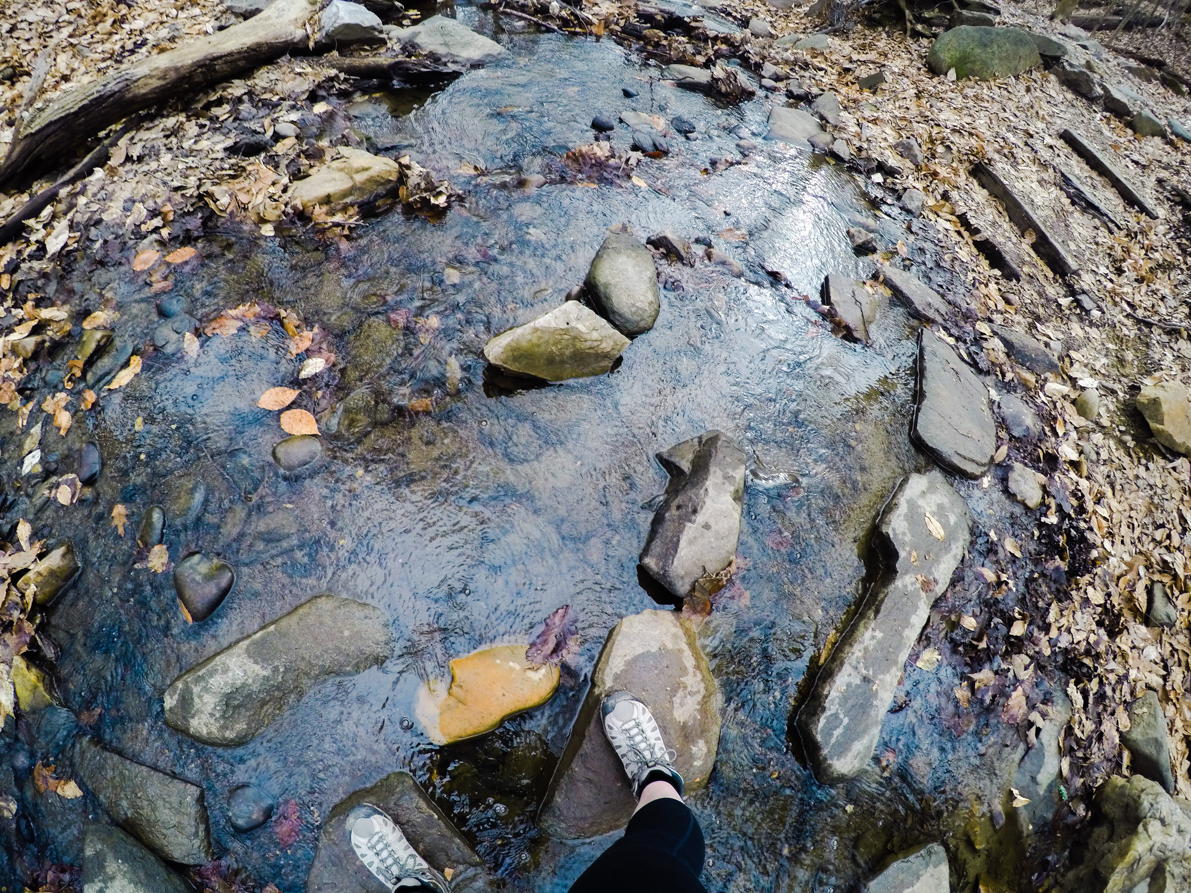
Shortly after starting the trail, we hit the first of four stream crossings. When I walked through this area the week before, I had a bunch of rocks to choose from for my creek crossings. Because we’d had incredibly violent storms earlier in the week, the water was a little higher than I was expecting. This time around, some of those handy rocks were submerged. Thankfully, the water flow was still pretty tame and we were both equipped with waterproof shoes.
 Parts of the trail were extremely muddy, and we had to use caution not to slip, especially on some of the uphill stretches. After a half mile, the tree cover became sparser and the large apartment buildings so common in Northwest DC loomed above us. With just a few more steps, we emerged next to Connecticut Avenue in the middle of the Van Ness neighborhood.
Looking across Connecticut Avenue, I could see what looked like the next yellow blaze for the Melvin Hazen Trail on a pole in an alley to the left of an apartment building. Going directly across the four lanes of Connecticut Avenue would have led to our untimely deaths, so we turned right and headed to the intersection at Sedgwick Street. We crossed (safely, with the light!) and backtracked to the alley.
Turning right into the alley, we went through a parking lot behind the building, spotting another blaze as we walked. At the end of the alley was a blaze-marked sign and steps leading us down to a marshy wooded area.
Because I did this part of the trail a week earlier, I thought I knew what to expect as we descended, but I was in for a surprise. The storm wreaked havoc on this part of the park. Trees and branches were down everywhere. At the foot of the steps was a wooden bridge, which had sustained heavy damage. A large branch had blown onto the bridge and caused some of the planks to cave in. Debris covered everything and at the end of the bridge, a falling limb had snapped the railing in half.


In retrospect, I should have suggested clearing off the bridge so the next group of people didn’t walk into a disaster zone. However, I was so shocked by the post-storm damage that I didn’t even think of it until I got home.
In this section, we also came across a huge tree that had fallen down during the storm. It was impressive and it was in our way. Sure, we could have walked around it, but we needed to get some impromptu climbing into our outing. Risking bottom splinters, up and over the tree we went!
 After .4 miles, we emerged from the woods at the intersection of Tilden Street and Reno Road. Crossing Reno, we made a right onto Springland Lane. Surrounded on both sides by enormous (at least by DC standards) single-family houses, it felt like we were trespassing in a private neighborhood.
The street dead-ended and straight ahead of us was a steep concrete staircase. At the top of the staircase was a wide, unpaved path and another flight of stairs. We ignored the second flight and turned right onto the path, emerging onto Idaho Avenue.
There were a lot of twists and turns to stay on our route. At the next intersection, we turned left onto Tilden Street and then made a right onto 37th Street. Walking along it for two blocks, we turned left at Van Ness Street and stayed on it until we hit Wisconsin Avenue.
We were just south of Tenley Circle where all kinds of food options lined the streets. If we’d needed a break or had a hankering for Cava Grill, this would have been the perfect spot for it, but we were too busy being hardcore to rest. We kept going, crossing Wisconsin and staying on Van Ness until we hit a grassy area and a large, brown National Park Service sign for Glover Archbold Park.
Walking through the open field at the beginning of the park, we passed several families and a few adorable dogs. Heading south toward the woods, we picked up the next section of the trail.


In our copy of 60 Hikes Within 60 Miles, it referred to this trail as “blue-blazed.” The only blaze color I saw on this part of the trek was yellow. As our official navigator, this made me nervous. Were we lost? Had I somehow taken us on some other trail? But then, I saw a sign indicating that we were still on Glover Archbold Trail, so I’m chalking this up to a change that was made following book’s publication in 2006.
After half a mile on this trail, we exited the woods onto another grassy field, which led us to Massachusetts Avenue just to the northwest of Macomb Street. We could see the yellow blaze across the street for the trail, but jaywalking Mass Ave, even on a weekend, isn’t safe. We turned right and started heading to the nearest crosswalk.
Around this time, we got it into our heads that we were nature photographers in pursuit of the perfect bird photo (no judgments, sometimes you need to focus on something while hiking). There were a bunch of small birds hopping around in front of the Berkshire apartment complex. We moved closer to take more expert pictures. That’s when Sireen spotted it, a very sad bird trapped under some type of garden netting.
 At first, I thought his head was trapped in the netting, and with only my first aid scissors, I didn’t think we’d be able to do anything without receiving a major pecking in return. Sireen was undeterred. She started fiddling with the netting trying to free the bird. It turned out that his neck wasn’t entangled, he was just pinned and panicking. She was able to lift the netting off high enough for the little guy to escape, making her the hero of the day!
Good deed accomplished, we headed back to the woods, walking .4 miles before reaching the next road intersection at Cathedral Avenue. A brisk .2 miles later, we crossed New Mexico Avenue and headed back onto Glover Archbold Trail.
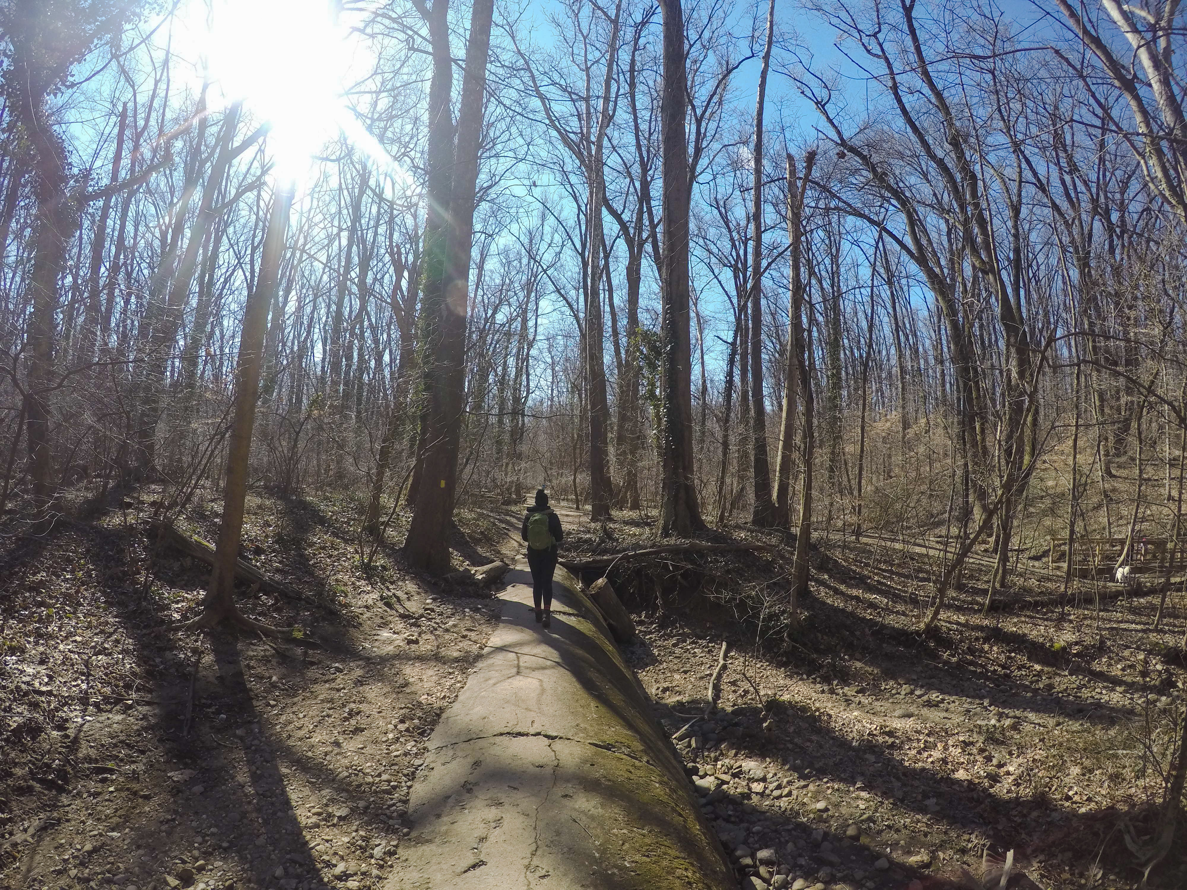
In this section, we discovered one of the most interesting features of Glover Archbold Park. Running through the park is a giant sewer pipeline. In most parts, the pipeline is buried in the dirt, but here, perhaps because of erosion, the pipeline is exposed. The whole look and feel reminded me of the Trestle/Pipeline Rapids Trail in Richmond but with less danger of falling into the James River.
After walking .75 miles, we reached a directional sign marking the intersection of two trails. As I recently learned, if you’re really focused on your walk, this sign is easy to miss – so be on the lookout! We followed the sign’s instructions and turned left onto Whitehaven Trail which took us east into Whitehaven Park.
This is another area where we found the 60 Hikes book outdated. The author referred to a “buff-blazed” trail. All around us were yellow blazes. Neither of us had any idea what a buff blaze could be – was “buff” some kind of color we’d never heard of? When I got home, I Googled it, and I was sure that I would feel dumb when I saw the results. I didn’t. I turned up a lot of links to the 60 Hikes book, nothing else. Maybe the writer was trying to make sure we were paying attention?
 We walked uphill for half a mile toward 37th Street. At the intersection, we crossed the street and turned left looking for what the book described as “ungainly” steps. I don’t know what an “ungainly” step is, but they must have redone these steps because they were wooden, sturdy, and surprisingly steep. They also made for a great photo op.
From there, it was .2 miles to 35th Street. We decided at this point to take a quick detour to Holy Rood Cemetery since it was mentioned in our trail book and neither of us had visited it before. Making a left on 35th Street and another left onto Wisconsin, we walked next to a high wall. Above it, I spied what looked like a grassy hill. I’d actually never been in this specific part of DC before, so I was surprised when we reached the corner and I saw that this hill was the cemetery.
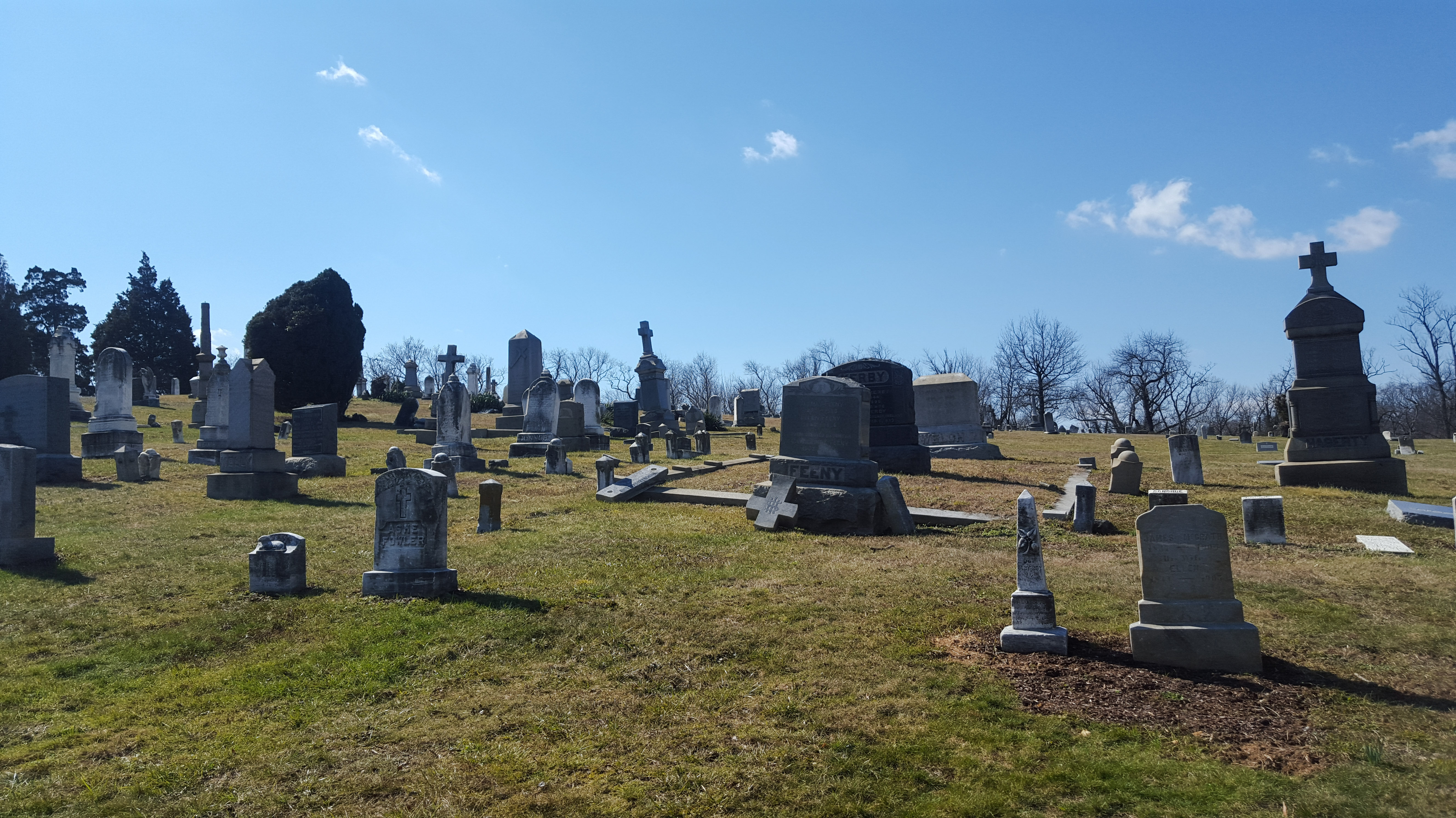 Established by Holy Trinity Church in 1832, Holy Rood Cemetery houses over 7,000 graves, including 1,000 for free and enslaved African Americans, and is currently owned by Georgetown University. The cemetery was not in the best condition, the grass was a little overgrown and a number of gravestones were toppled over. I don’t think its state was quite as bad as described in this Washington Post article from 2008, but it was still a shame.
Leaving Holy Rood, we turned right on Wisconsin and went two blocks to Whitehaven Street. Turning right, we walked to where the road begins to curve to the left. To our right, was a sign directing us downhill and onto the Dumbarton Oaks Trail.
I’d briefly been in Dumbarton Oaks Estate before, but I had no idea there was a 27-acre park adjacent to the gardens.
At one time, the park was also part of the Estate but in the 1940s, the land was given to the National Park Service to manage. Sadly, in the years under their care, the park started to fall into disrepair. This shame was magnified by the fact that the original landscaping was designed by Beatrix Farrand, America’s first professional female landscape architect.
Members of the local community agreed that the park was in a sorry state, and in 2010, the Dumbarton Oaks Park Conservancy formed with the mission of partnering with the National Park Service to restore the park to its former glory. Their work restoring the land and combatting the effects of erosion was visible as soon as we walked into the park.


At first, I thought we were heading into a barren, sad space, but my impression changed once I spotted the wooden plank bridge splayed over a small stream. We crossed the unsteady bridge and walked along the trail to the right of the stream.
The atmosphere was amazing, like a small, private sanctuary. The stream was directed into a series of artful cascading waterfalls. To our right was a stone wall covered in electric green moss. This part of the route was only a quarter mile, but it was one of my favorite parts of the entire hike.
At the end of the stream trail, we reached a stone wall and two large wooden doors that looked like they could be part of a castle. Exiting Dumbarton Park at the gate, we went on the trail to the right (the one with the no bikes sign) and took it back to Rock Creek Trail.
One point of contention with our trail book, 60 Hikes Within 60 Miles says that this route is 9.4 miles. When I plugged it into Map My Run, I only got 8.48 miles. I’m not sure why there was such a big difference. We did some things differently from the book, like looping from the zoo instead of Woodley Park, but nothing that would cause almost a mile difference.
My ratings
Difficulty – 1
Solitude – 1
Fun – 3
I loved the diversity of this hike. There were so many twists and turns to keep track of that I never got bored with the route. I loved the inside view that we got of northwest DC. I felt like we were uncovering a whole new side to the city as we walked through parts that I’ve never seen before.

Been meaning to check this place out!!
LikeLike
I hope you make it over there. With everything blooming, it’s probably even nicer now!
LikeLiked by 1 person
Pingback: Hidden in DC: Meridian Hill Park | City to Trail
Great article! The Potomac Appalachian Trail Club maintains many of these trails with NPS, and we know all about the challenges you observe here. A couple of quick notes: The strenuous section of the Western Ridge Trail is and has been open. The confusing part might be once one reaches a prominent tree about halfway through. One needs to skirt over the roots on the creek side of the tree and use the rock outcroppings to descend (if going north to south). It’s easier to see what to do going south to north. On the west half of the Melvin Hazen Trail, that bridge receives debris after every major storm from all of the stormwater runoff going into the stream, and we are always replacing pieces of it. Glad you had a good hike!
LikeLiked by 1 person
I love that you shared your experience hiking with a friend and exploring new trails.
LikeLike